The Mi-Star system is comprised of multiple modules that provide everything from differential GPS automated steering and GPS inventory management to virtualized operations viewing and centralized fleet management.
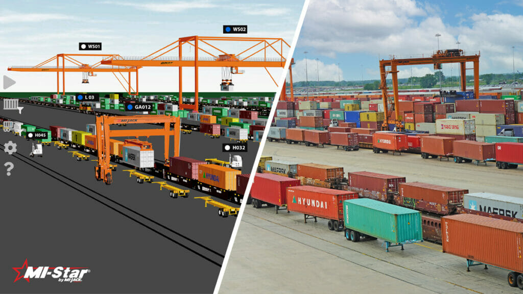
AccuView lets you zoom in to a tight scale view of an individual vehicle, or out to a panoramic view of the entire yard. You can even view multiple perspectives in separate windows simultaneously on the same workstation. The application supports multiple simultaneous viewers and can be shown in both 3D and 2D.
Uses differential GPS to steer machines down a predefined path, increasing productivity up to 25% while reducing operator fatigue.
A gate-to-gate virtual view of the state of your freight, graphically representing the current state of terminal operations in real-time and historical.
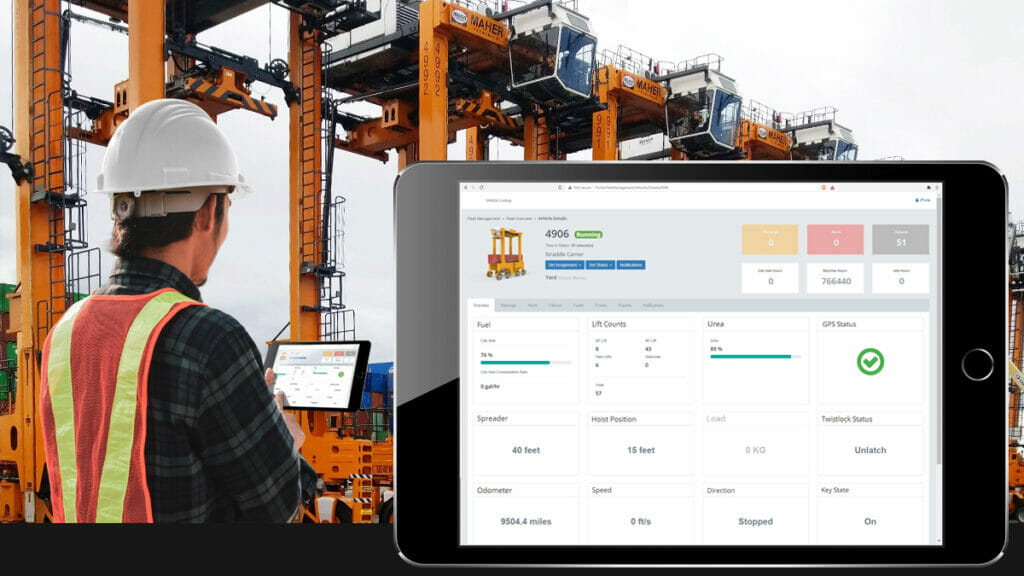
Enables terminal management to boost productivity improving visibility into operations to gain critical insights.
Mi-Star’s GPS inventory management system module, uses Position Detection System (PDS) technology to map all facility container inventory.
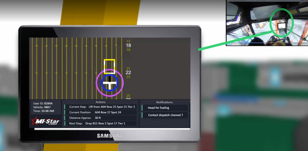
Provide equipment operators access to powerful visualization tools in-cab using the VehicleView module of Mi-Star.
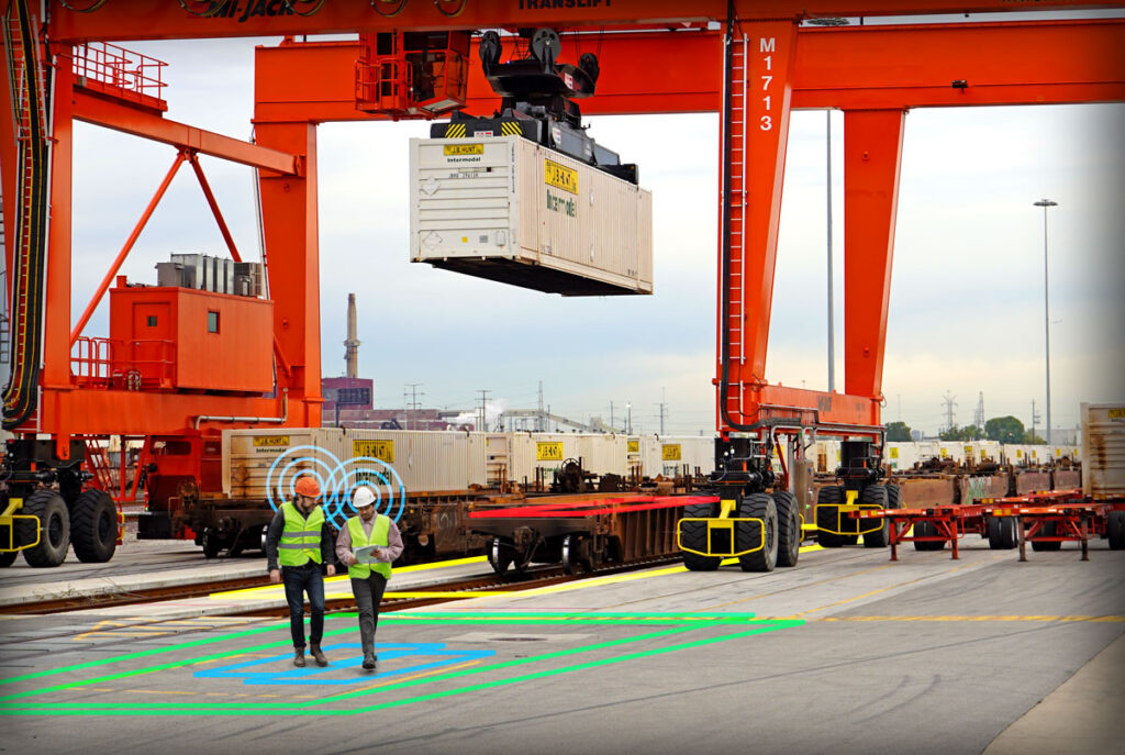
AccuTrack offers precise personnel and asset tracking with optional work zone protection using advanced technologies for streamlined operations.
What makes Mi-Star so accurate?
Mi-Star™ employs a NovaTel GPS receiver system in conjunction with our advanced inertial navigation system to enhance position accuracy during instances of satellite communication interruption. Originally designed for auto-steering rubber tire gantry cranes, the Mi-Star™ system required precise position accuracy to navigate these large cranes along straight or curved paths. This exceptional level of accuracy extends to our PDS solution, ensuring reliable performance across our product line.
Why does 2 cm accuracy matter if sub-meter systems are available?
Marine and intermodal facilities often struggle with satellite connectivity due to environmental factors. When this connection is lost, tracking vehicles accurately is challenging unless inertial navigation or other methods are used. The initial accuracy of the tracking system is crucial: starting with sub-meter accuracy introduces larger errors in a vehicle’s last known position than starting with 2cm accuracy. This difference can significantly impact container tracking, as errors of a meter or more greatly affect position accuracy.
How does mapping resolution impact inventory accuracy?
Mapping resolution measures how accurately a facility’s lines are mapped to GPS coordinates. If both the mapping resolution and the container handling equipment (CHE) accuracy are sub-meter, operators might see up to a 2-meter position variance even before losing connectivity. Mi-Jack uses a very accurate mapping solution, where each pixel represents 3 inches on the ground, ensuring precise tracking and minimizing positional errors.
What sets the Mi-Star warranty apart from other providers?
In technology, improvements in hardware and software continue after the initial purchase. However, when components or software become outdated, customers usually have to pay for updates. At Mi-Jack Products, we focus on building long-term partnerships with our customers. Our extended warranty program protects against these “end of life” events, providing a predictable cost of ownership and ongoing protection.
I have my own IT procurement group, what if I want to supply servers and database licensees?
Mi-Jack is flexible when it comes to servers and database licenses. As your partner, we want to work with you to ensure you receive the best value and performance. We do not demand that you use our servers or database licenses.
Do I have to use your CHE screens and system to manage the messaging traffic to and from my TOS?
Mi-Jack is not a Terminal Operating System (TOS) provider and therefore we are designed to be a pure position detection system (PDS). While we are closely integrated to the TOS, we do not attempt to function as the TOS and manage messaging. You can use your existing messaging methodology or we can collaborate to find a mutually beneficial solution that maximizes your performance.
How can I avoid cost overruns from change orders and scope creep in my next technology deployment?
At Mi-Jack, we focus on delivering complete solutions to our customers. Before giving cost estimates, we visit the site to check the project’s scope, integration, and installation needs. This way, we ensure the project stays within the agreed budget. Our quotes are designed to fit the customer’s financial limits, reducing the risk of cost overruns from changes or scope creep.
I have a complex operation and need a customized solution. How can Mi-Jack support my needs?
Mi-Jack knows that every operation is different, which is why our Mi-Star solution is flexible and can be tailored to various industries, including marine, intermodal, industrial, and steel. We’ve been in the transportation industry since 1955 and have the expertise to create customized solutions for complex challenges. Our team works closely with customers to combine operational insights with technology, delivering added value in every project.
I have a Navis TOS, how will this affect my project success?
Mi-Star is TOS agnostic and has been successfully integrated to Navis as well as Tideworks and RMI. Since we do not typically perform TOS functionality within our system, the integration to the TOS is a much more streamlined effort than with other systems.
We have strategic service locations throughout the world: